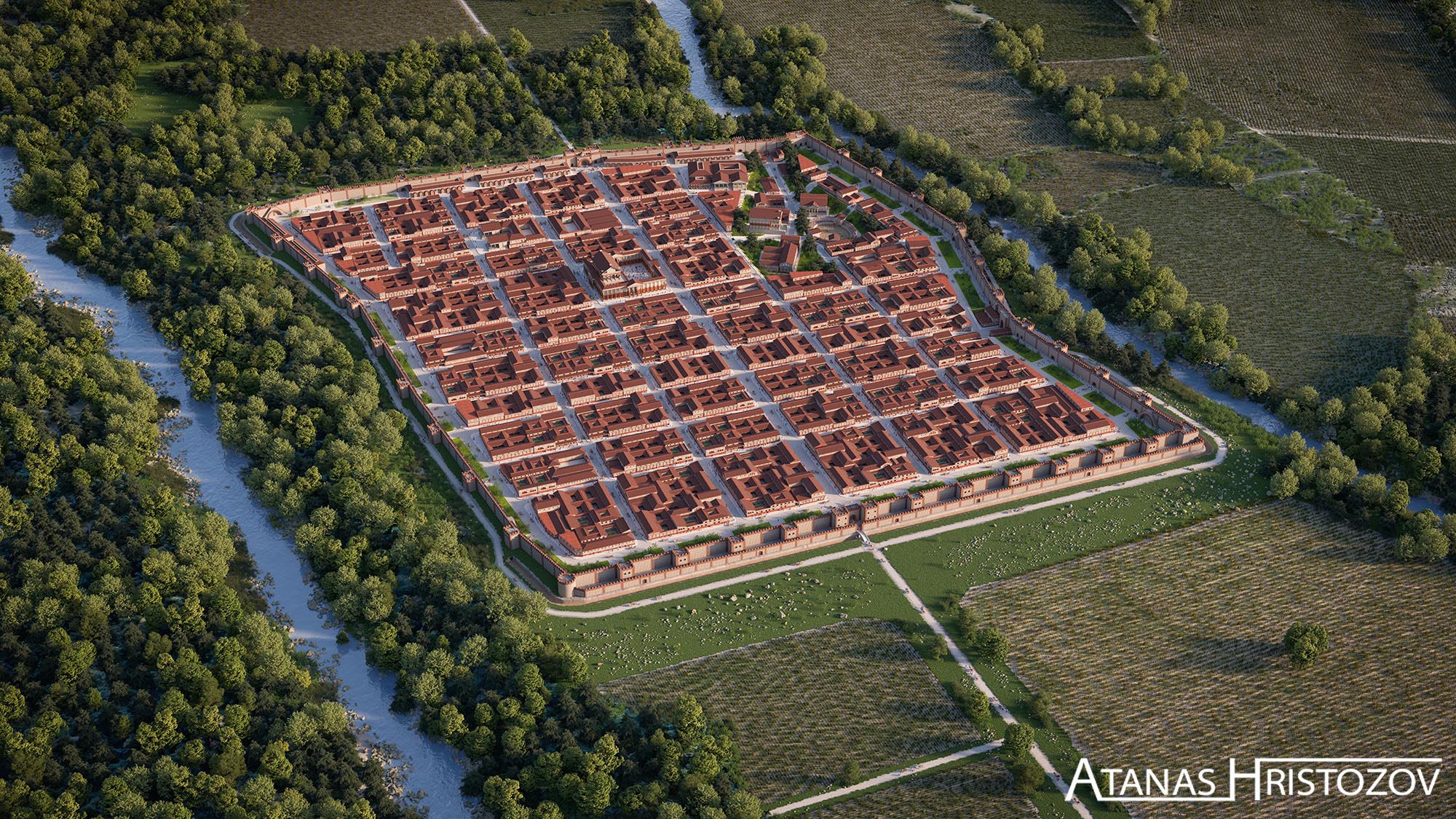
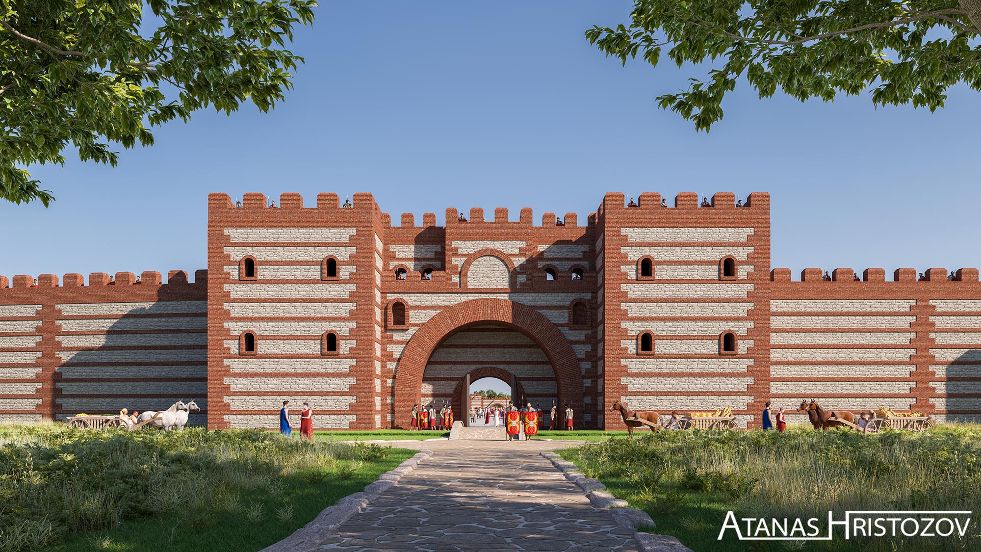
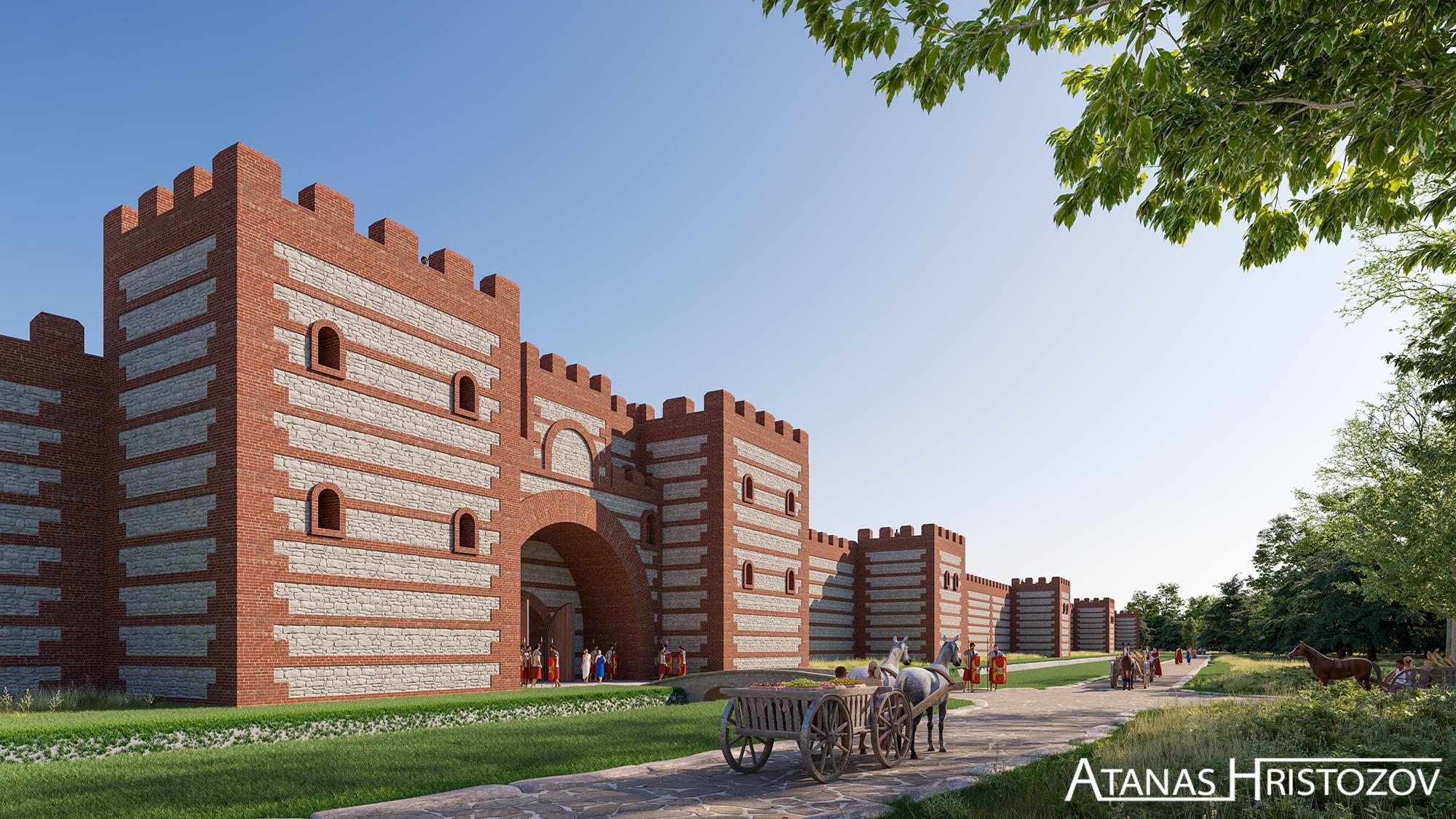
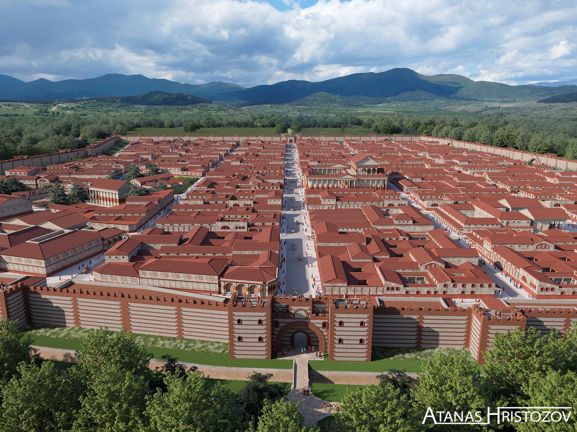
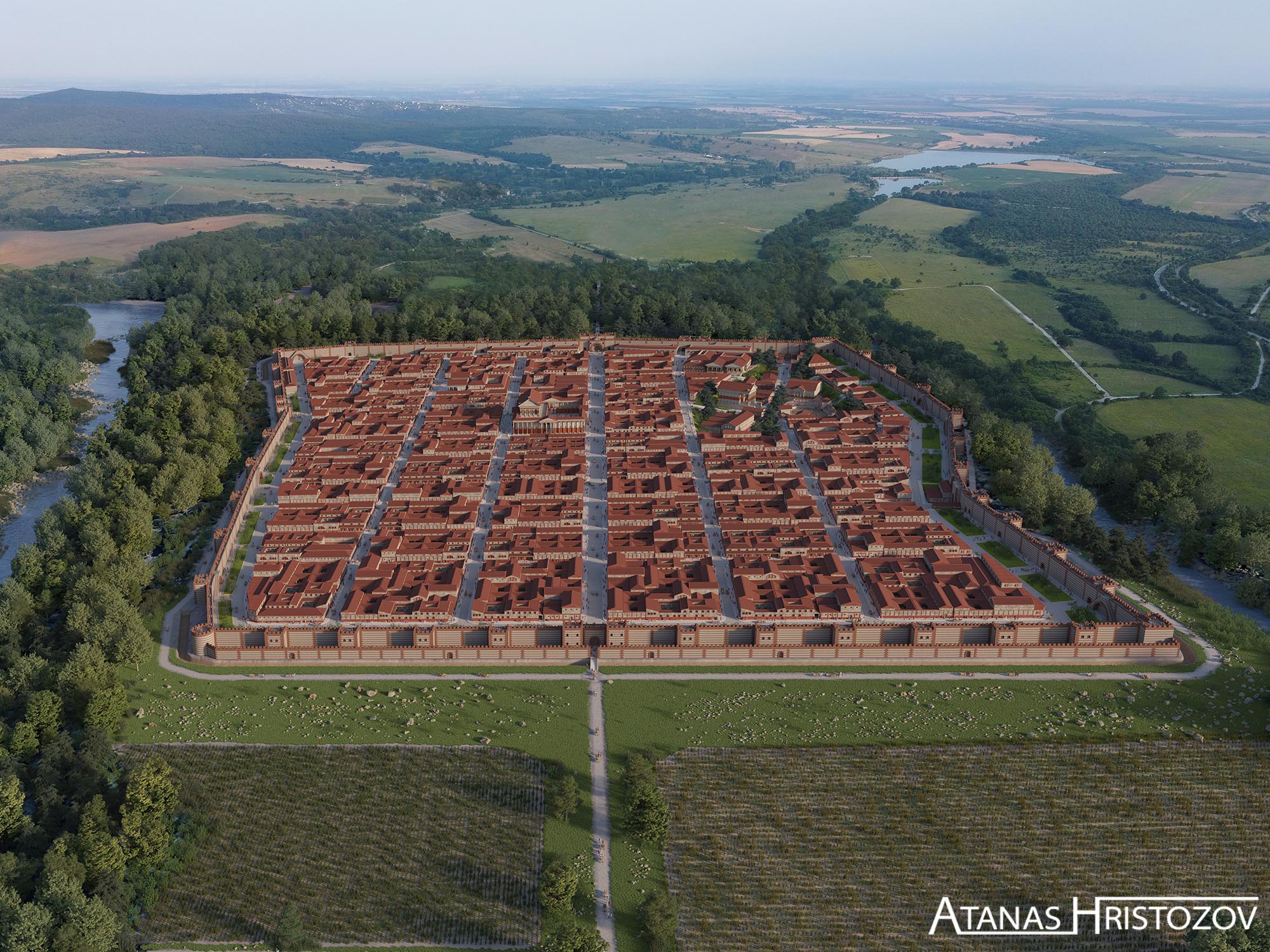
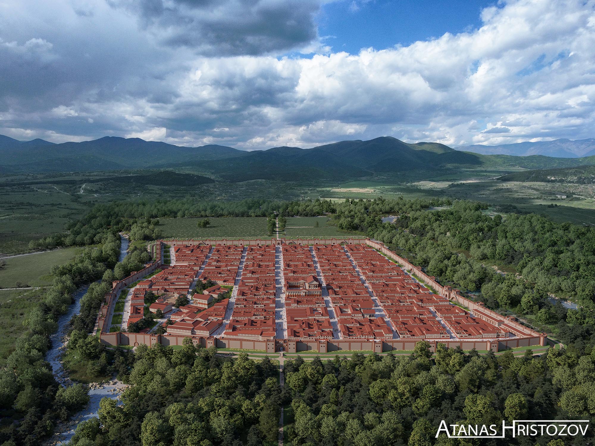
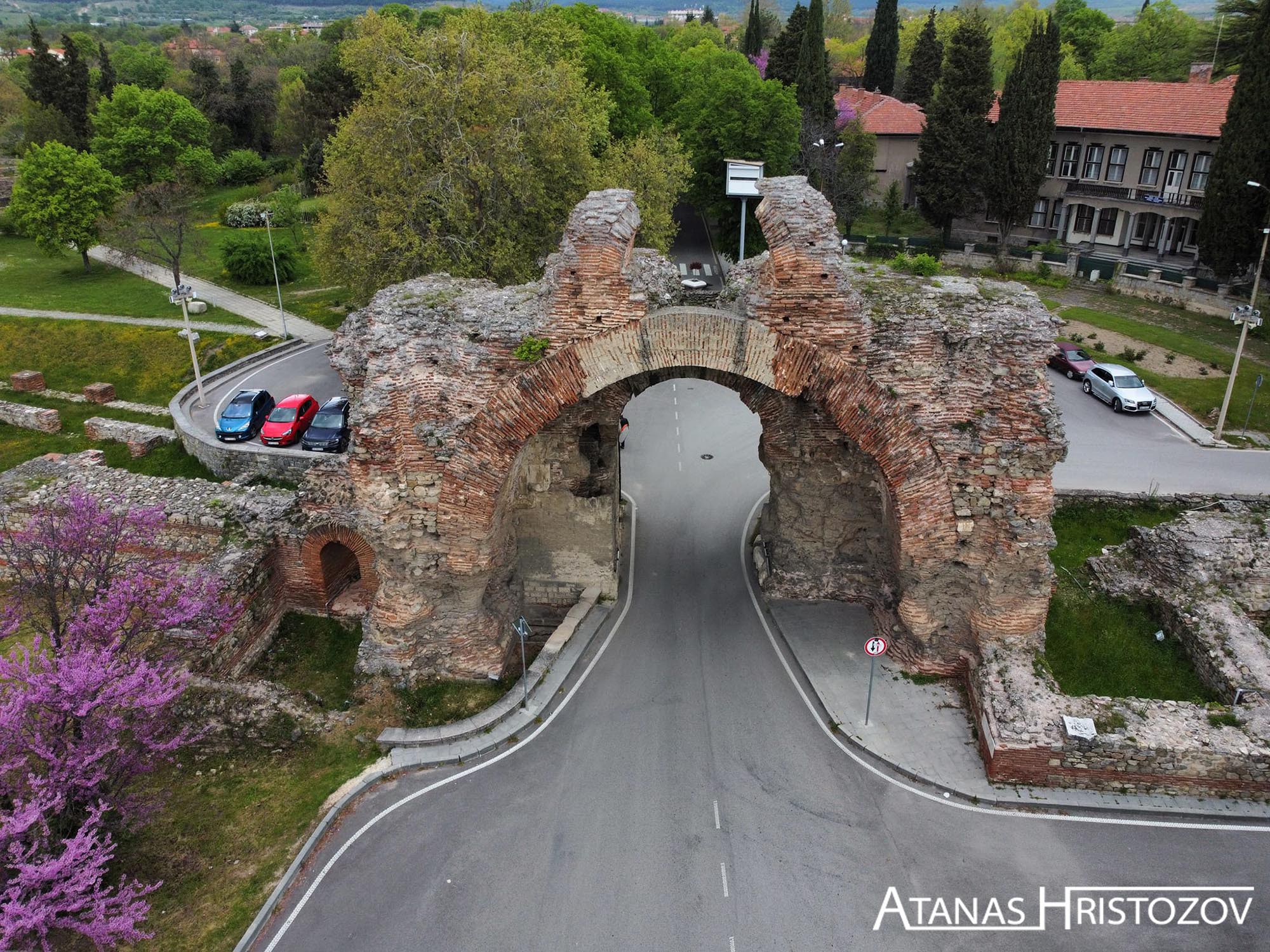
Diocletianopolis CG Reconstruction
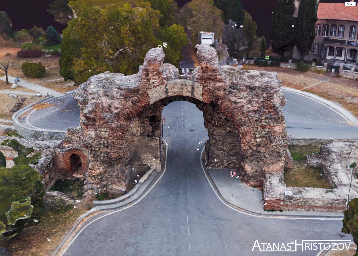
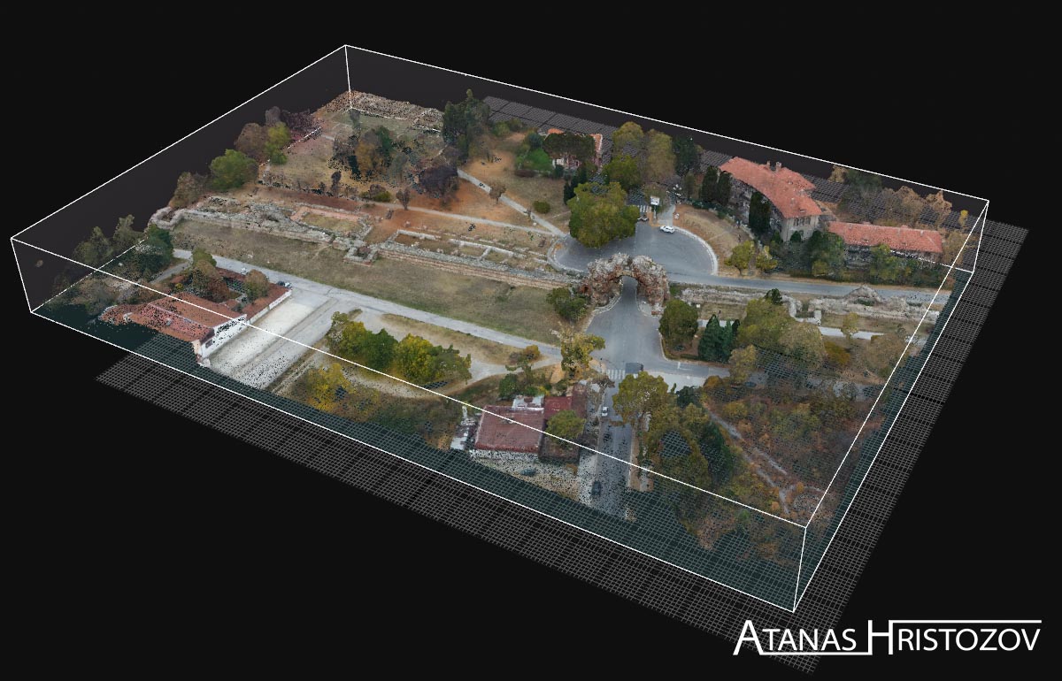
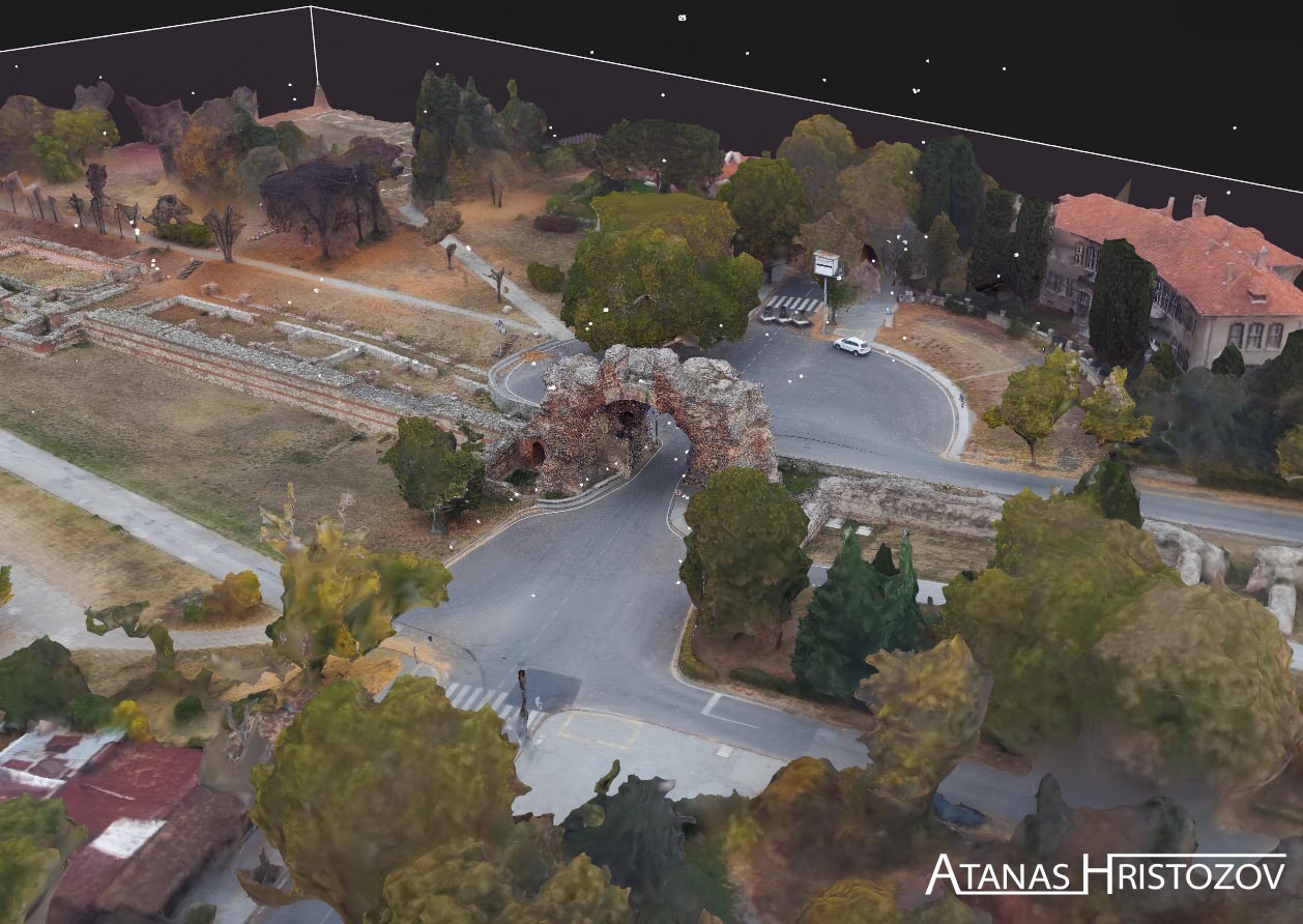
A CG reconstruction of the city of Diocletianopolis. The reconstruction is aiming to recreate how the city might have looked like in the period III - V century. The reconstruction is done by scanning the present archeological site of the roman city, using drones and other scpecialized cameras. After the scan, a 3D model of the city wall was created. The final 3D reconstruction of the city was done based on this model and research for similarities from other roman towns from this period.
Slide left-right
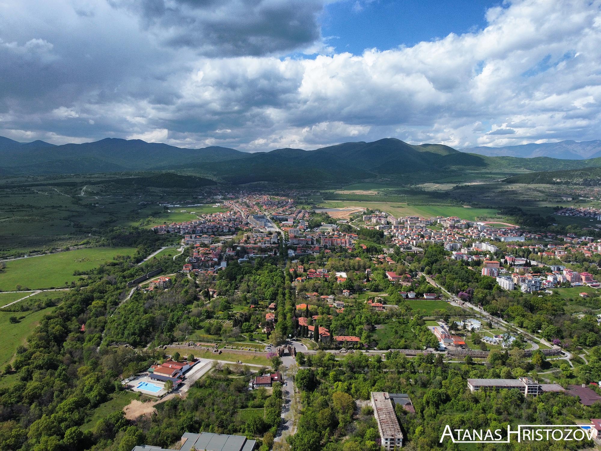
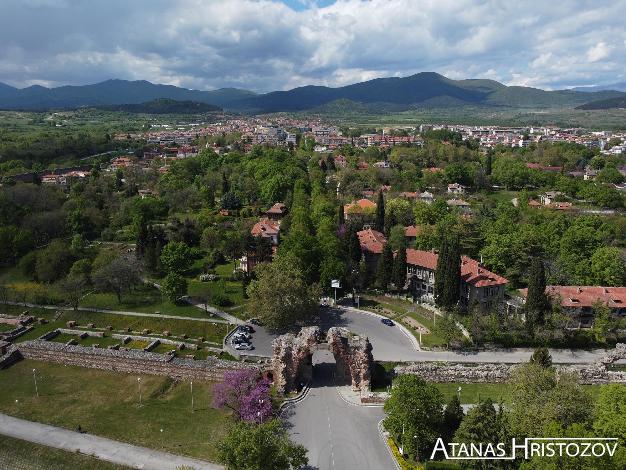
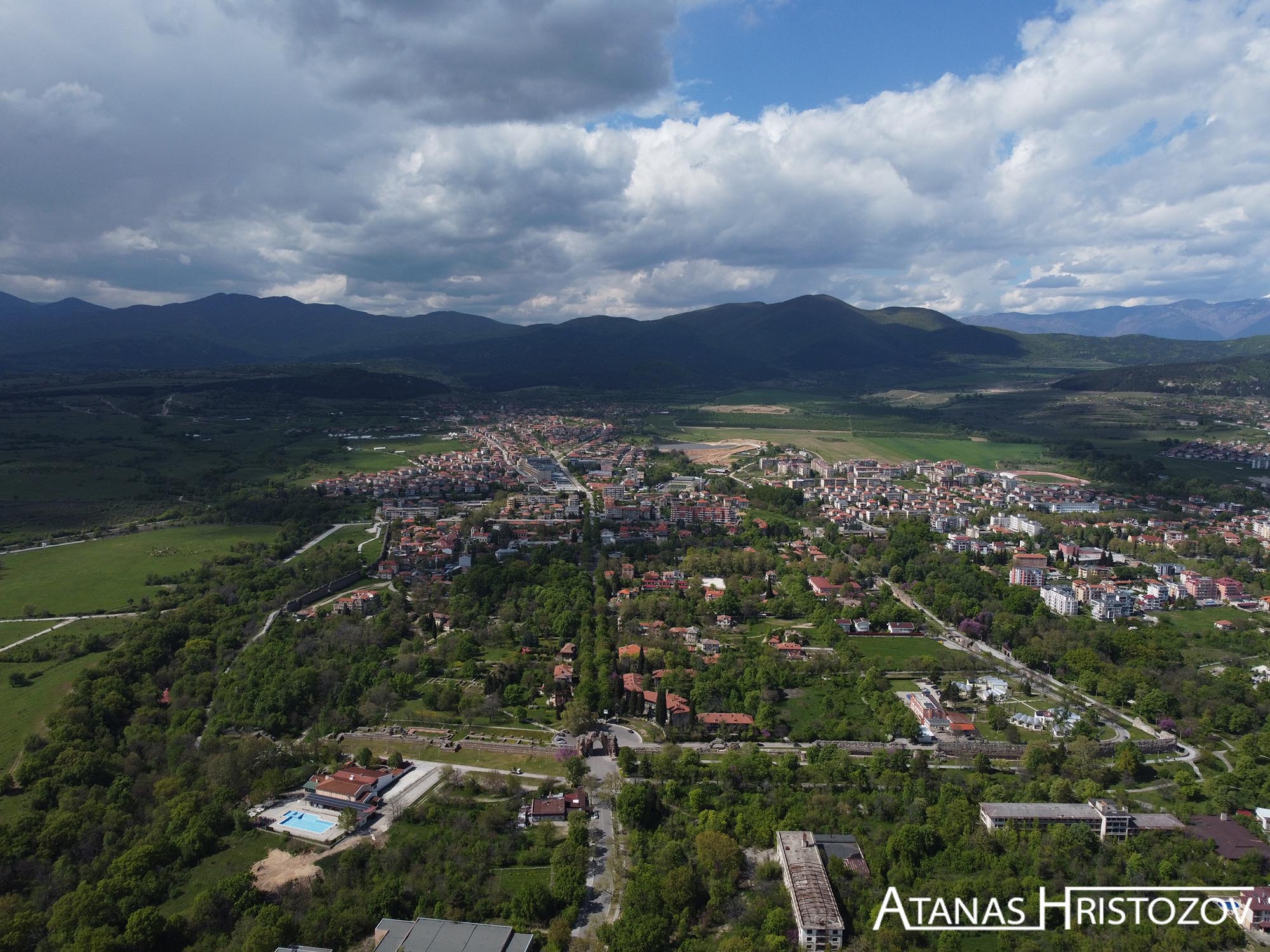
A comparison between the city from IVth century and the cith from XXI censtury.
Capturing the images
Capturing drone images for photogrammetry involves using unmanned aerial vehicles (UAVs) equipped with cameras to capture a series of overlapping photographs from different perspectives. The process typically includes the following steps:
Flight Planning: Before the drone is launched, a flight plan is created using specialized software. The flight plan defines the area to be surveyed, the altitude, and the desired image overlap. The software generates a flight path for the drone to follow, ensuring comprehensive coverage of the subject.
Pre-flight Checks: The drone operator performs pre-flight checks to ensure the drone is in proper working condition. This includes inspecting the drone, checking the battery levels, and verifying that the camera settings are appropriate for the desired imagery.
Launch and Flight: Once the necessary preparations are complete, the drone is launched and follows the predefined flight path. It autonomously captures a series of photographs as it moves through the planned trajectory. The drone's built-in positioning systems, such as GPS, assist in maintaining stable flight and precise positioning.
Image Overlap: To ensure accurate photogrammetric results, it is essential to have sufficient overlap between the images. Overlapping images capture common features from different angles, allowing for triangulation and accurate 3D reconstruction. The amount of overlap required depends on the desired level of detail and the type of objects or terrain being captured.
Ground Control Points (GCPs): For increased accuracy and georeferencing, ground control points may be used. GCPs are markers placed on the ground with known coordinates. The drone captures images of these markers, which serve as reference points for the photogrammetry software to align and scale the resulting 3D model with real-world coordinates.
Data Storage: The images captured by the drone are typically stored on an onboard memory card or transmitted to a ground station in real-time. It is crucial to ensure the images are securely stored and protected to prevent data loss.
Post-processing: Once the drone flight is complete, the images are transferred to a computer or a dedicated workstation for post-processing. Specialized photogrammetry software is used to analyze the images, identify common features, and reconstruct the 3D model. The software takes into account camera parameters, lens distortion, and image scale to generate accurate measurements and a detailed 3D representation.
Data Output: The output of the photogrammetry process can include various products, such as point clouds, textured 3D models, orthomosaics, and digital elevation models (DEMs). These outputs can be used for visualization, measurements, analysis, or integration into other software or systems.
Reconstruction with Photogrametry
Photogrammetry is a field that involves the measurement and interpretation of photographs or images to extract precise information about the physical properties of objects or environments. It is a technique used to create accurate 3D models, maps, and measurements by analyzing the geometry and appearance of photographs.
The process of photogrammetry begins with capturing a series of overlapping photographs from different angles using specialized cameras, drones, or even satellite imagery. These photographs are typically taken from different positions and orientations to ensure comprehensive coverage of the subject or area of interest.
Once the images are obtained, photogrammetry software analyzes the photographs and extracts relevant information. This analysis involves identifying common points or features in multiple images and triangulating their positions in 3D space. By measuring the relative positions of these points in different photographs, the software can calculate the 3D coordinates of the objects or surfaces being captured.
Photogrammetry algorithms also take into account factors such as camera parameters, lens distortion, and image scale to ensure accurate measurements. By incorporating multiple images and viewpoints, photogrammetry can generate highly detailed 3D models with precise measurements of distances, angles, and surface properties.